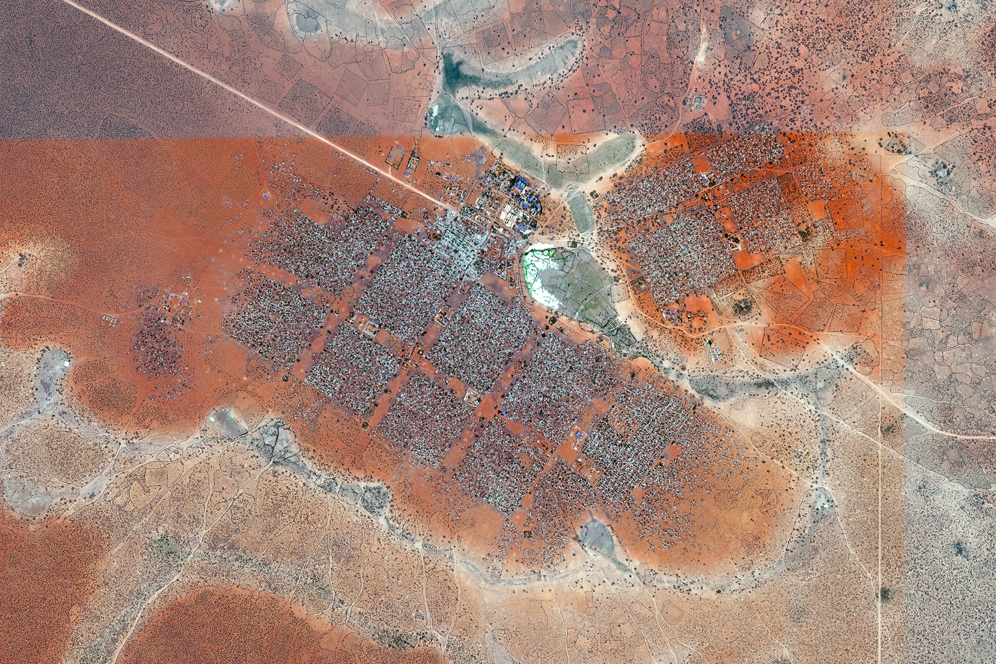
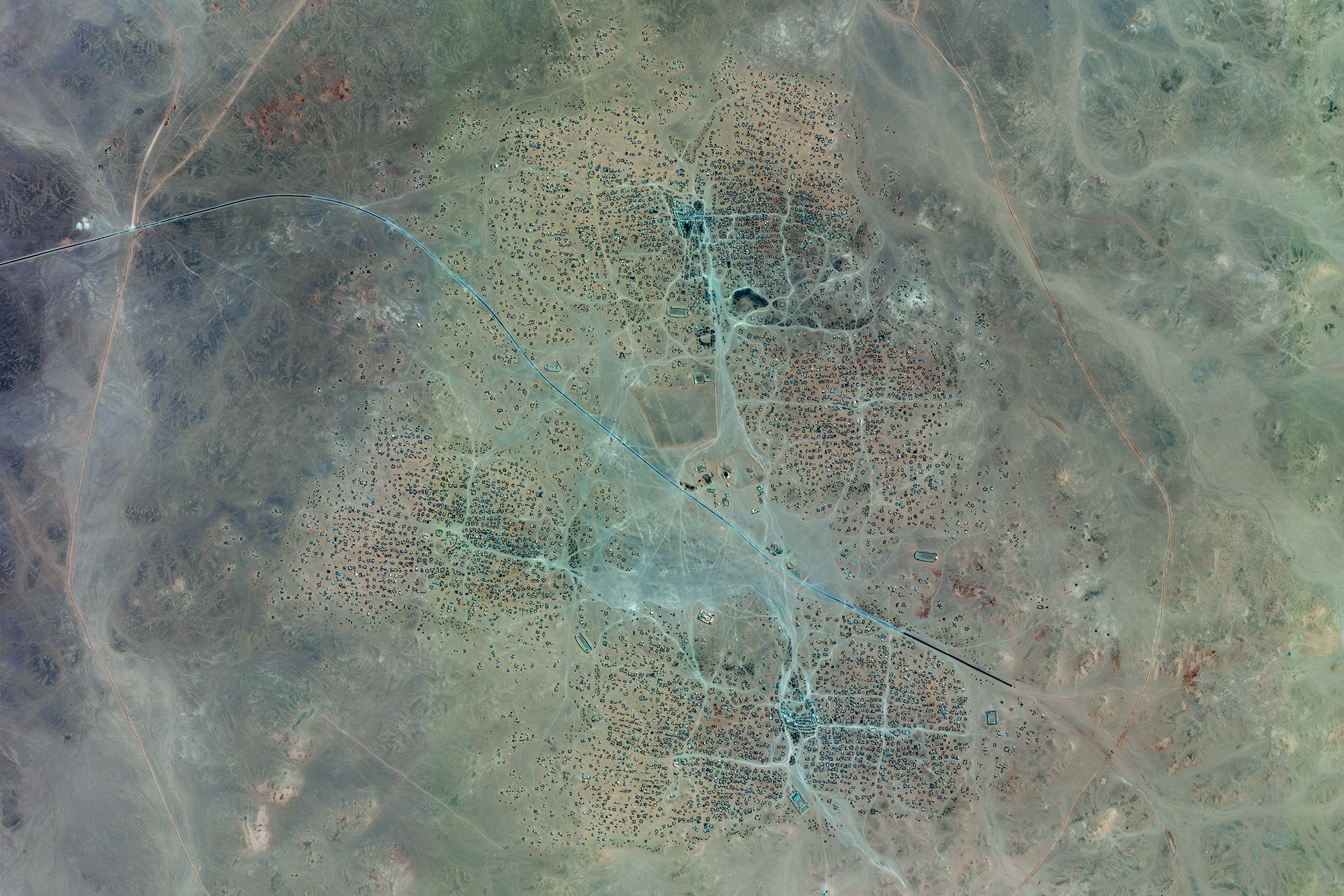
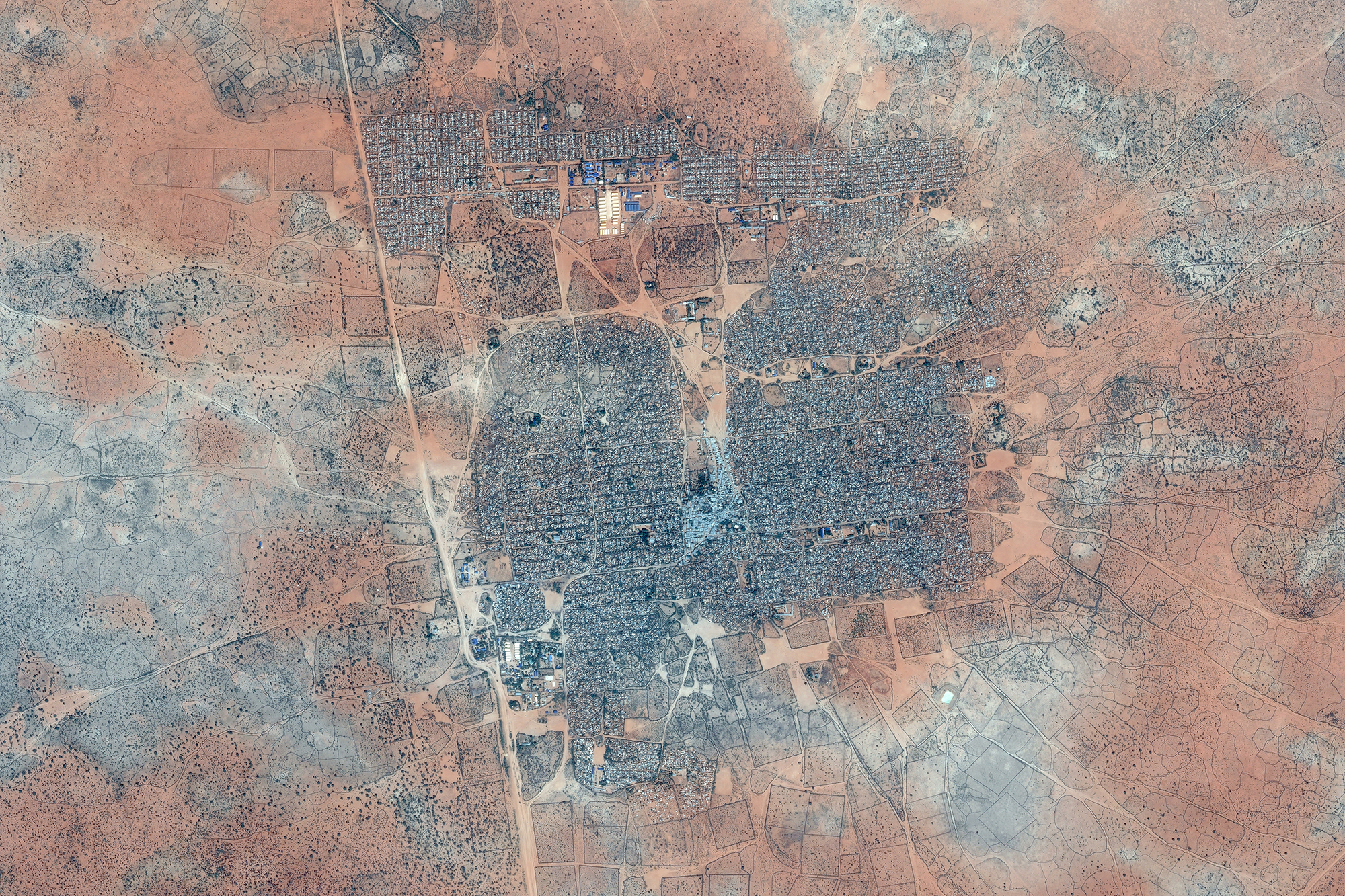
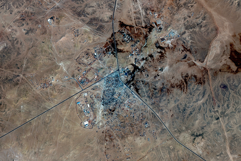
Mass migration has led to the creation of new residential areas.
Although in Europe we still don’t realize it because the cases are limited, it does not mean that this is not happening elsewhere in the world. In Europe, Calais was the most striking example of the refusal of cohabitation in favour of detention. Real cities have been shaped by decades of mass migration and the most clear examples of this phenomenon is to be seen in Africa, especially in Kenya, Chad and the Western Sahara.
Satellite imagery is the means that explains this evolution most consistently.
These satellite-cities - even if these are often not regarded as de facto cities - develop as real urban conglomerates, each one differently depending on their geolocalisation and its inhabitants.
The goal of “Satellites” is to analyze these new cities through satellite imagery in order to assign these places a visual dignity while investigating their evolution following the principles of town planning.
In addition, we want to underline how public satellite imagery in Europe (e.g. Google Earth) shows no traces of these conglomerates, which points to a “censorship” that prevents the matter from becoming understandable. . Exemplar is the case of Calais, where public satellite imagery ceased being updated between 2004 and 2015, even though refugee camps were clearly spreading around the town. I soon realized that public imagery wasn’t updated and showed no traces of the refugee camps that were being established in that area over the years. Parallel to this, it’s interesting to see that satellite imagery is being used in the African refugee camps to keep track of their evolution.
I decided to focus on Africa and some specific countries in particular, because it allowed my visual narrative more heterogeneity and unicity. Also, I had access to more representative imagery and accurate data.
Every image is the result of the stitching together of hundreds HD screenshots.
A more in depth description can be found here.